MT802
A comprehensive agricultural automation system, integrating satellite reception, positioning, navigation, and driving, compatible with various tractors and suitable for all farming procedures.
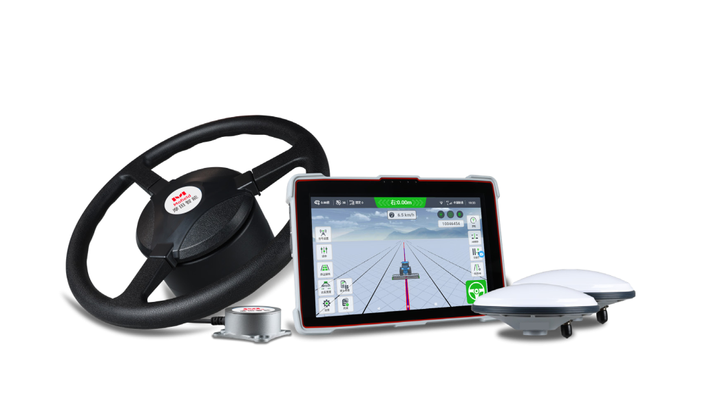
MT802
GNSS AUTOMATED STEERING SYSTEM
MT802 is a comprehensive system integrating satellite reception, positioning, navigation and automatic driving. It is mainly composed of a GNSS tablet, electric steering wheel, angle sensors and GNSS antennas. Multiple work modes such as Straight, Curve, Automatic U-turn, Pivot can be switched freely. AG502 is compatible with a variety of mainstream tractors on the market, and can be applied to all farming procedures, like ridging, seeding, spraying and harvesting.
- MT802 GNSS AUTOMATED STEERING SYSTEM
- MT802 GNSS 自动转向系统
RIDGING
SEEDING
SPRAYING
HARVESTING
MT802 GNSS AUTOMATER STEERING SYSTEM
Mofield MT802 Intelligent is a smart control system independently developed by Futrobo inc., based on the high-precision GNSS ,it supports a-terrain operations and can achieve automated agricultural cultivation within an accuracy of ±2.5cm, With a 10.1-inch high-definition screen. one-ouch operation is made simple.The system features a high-torque electric steering wheel for smooth control, a highly integrated design for easy installation,and is equipped with the industry’s high-performance Comav K8 series boards for stable signals and smooth operation. It is suitable for the entire process of agriculture practices, contributing to a bountiful yield on farms.
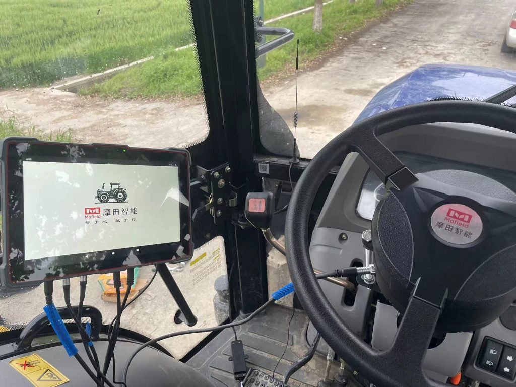

Electric Steering Wheel
- High torque with millisecond response, quick response for large angles,and high sensitivity for small angle adjustments.
- Universal compatibility, suitable for a variety of agricultural machinery types.
In-Vehicle Display and Control Terminal
- Physical buttons for one-touch startup.
- 10.1-inch high-definition screen, glare-resistant, easy touch control.
- Built-in internet module, supporting network communication.
Satellite Antenna
- Multi-frequency, multi-frame high precision.
- Supports global mainstream satellite systems, stable and anti-interference signal.
Vehicle Attitude Sensor
- Three-axis attitude sensor adapts to various terrains including flat land,
paddy fields, slopes, and more.
PRODUCT FEATURES
Satellite + ground, unaffected by lack of network
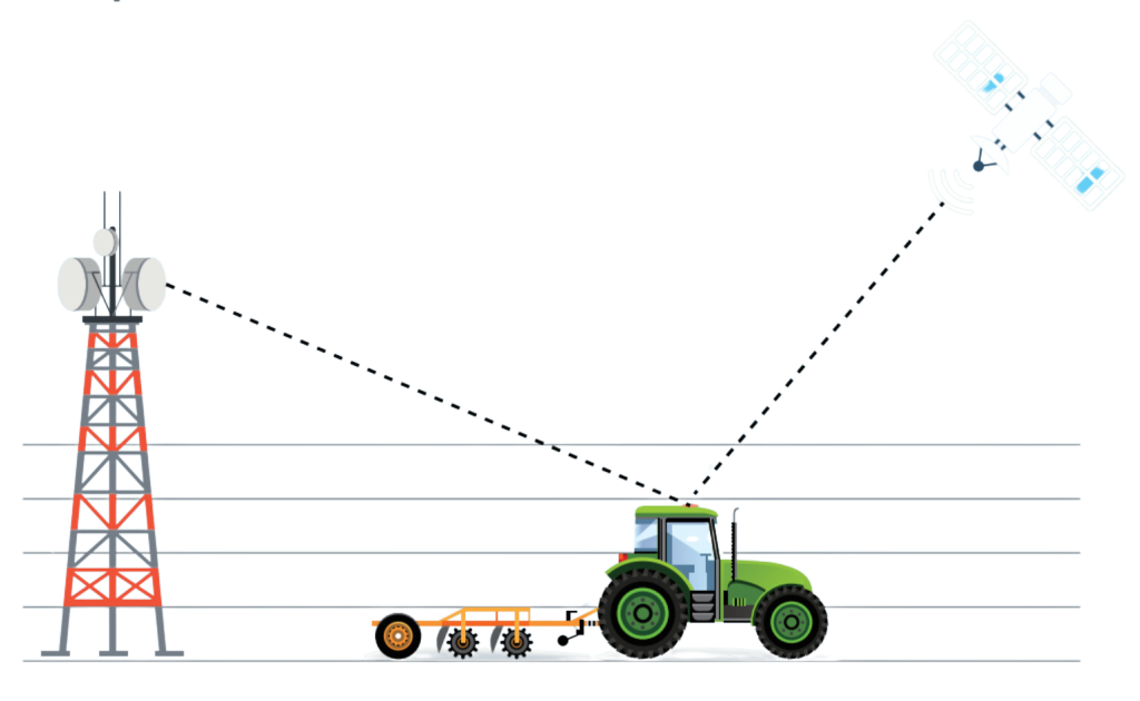
Adapt to Complex Terrain
Supports straight lines, curves, diagonal harrowing, and sloped terrain; suitable for both high-speed and low-speed operations in paddy and dry fields.
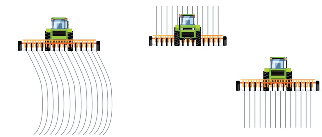
Worry-Free Automatic Parameter Adjustment
Capable of adaptive parameter calibration and automatic heading calibration,eliminating manual calculations, making operations simple and labor-saving.

Easy-to-Learn Operational Guidance
Straightforward tablet touch operation, clearly visible machine status, and quick mastery even for beginners.

TECHNICAL PARAMETER
| SATELLITE SYSTEMS | |
| GPS | L1,L2 |
| BDS-2 | B1l,B3l |
| BDS Global | B1C,B2b |
| GLONASS | G1,G2 |
| Galileo | E1,E5b |
| QZSS | L1,L2 |
| SATELLITE ACCURACY | |
| Post Processing | 2.5mm+1ppm,5.0mm+1ppm |
| Velocity Accuracy | <0.02m/s |
| Azimuth | (0.2/R)° |
| Roll or pitch | (0.4/R)° |
| RTK | 8+ 1ppm Horizontal,15+1ppm Vertical |
| SMART TABLET | |
| Display size | P300:10.1"touchscreen |
| Weight | P300:10229 |
| Operating System | Android 7.1 |
| CPU | 8-core 2.0GHzhigh-speed processor |
| RAM | 2GB (4GB is optional) |
| ROM | 2GB (4GB is optional) |
| Datalink Module | U70 module,410-470MHz full band (optional) |
| Input power | 5V-16V DC |
| Power consumption | <15W |
| ENVIRONMENTAL CHARACTERISTICS | |
| Working temperature | -20℃~60℃ |
| Waterproof and dustproof | IP66 |
| Shock and vibration | Designed to meet MIL-STD-810H |